
Results of the collaboration between the innovation projects “BIM” and “Applications of the drones”

This post is also available in the following languages: Euskara, Español
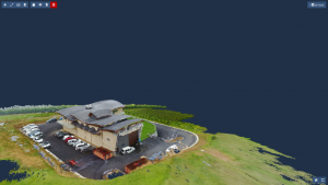
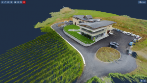
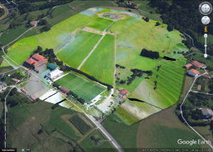
Within the framework of collaboration between the innovation projects “BIM” and “Applications of the drones” developed in the CIFP Bidasoa LHII, a detailed analysis of Hika Txakolindegia has been carried out.
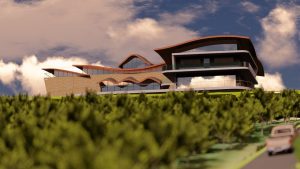
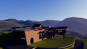
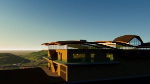
In order to carry out the work, two flights have been made (one with RGB cameras and another using multispectral ones). From the RGB images a cloud of 20 million points was generated on which, using BIM techniques, the modelling of both the land and the building was carried out. With the multispectral data, a study of the state of the vineyard has been carried out, which we hope will provide applicable information for the next season.
The example shown shows the usefulness of data capture by drones, BIM modelling, infographics … in real applications. This trend is expanding and integrating into the work methodologies of the most advanced companies; thus, generating new business opportunities.