
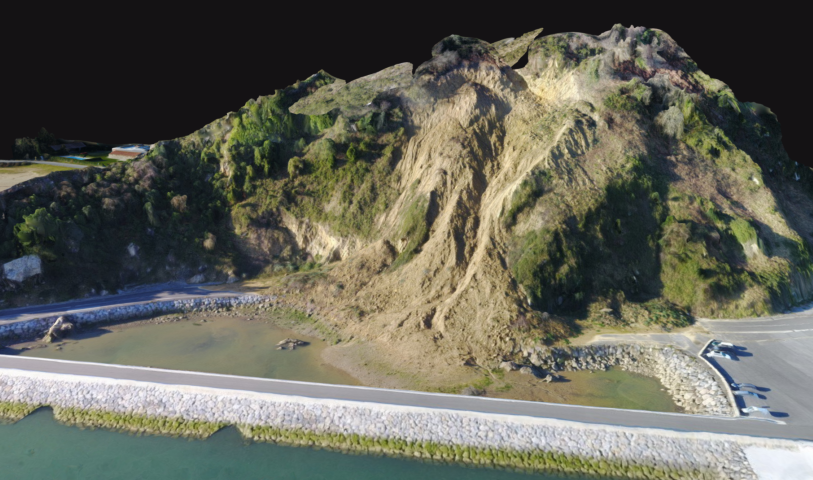
3D modelling of the new access to the Fishermen’s Brotherhood in Orio
In About Tknika
This post is also available in the following languages: Euskara, Español
Using a DJI Mavic drone, a photogrammetric study was carried out by using a DJI Mavic drone; creating a 3D model of the new access to the Fishermen’s Brotherhood in Orio, built after the landslides of 2014.


By means of this topographic work done with low cost drones, it has been tried to contrast the usefulness of the obtained point clouds, for later use in “classic topography” applications (contour curves, cubicle of volumes …). By fixing support and control points, it has been observed that from a height of 100 m can be obtained precisions close to 5 cm; therefore, this methodology offers acceptable results, in addition to presenting numerous other advantages.